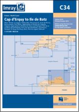
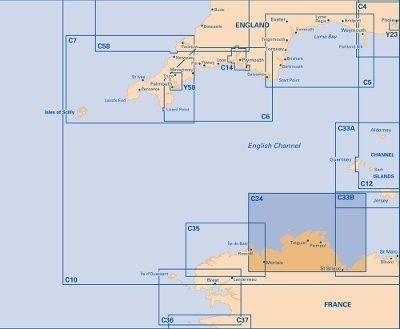
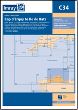
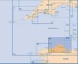
IMRAY C34 - CAP D''ERQUY TO ILE DE BATZ
Artikelnummer:
C34
Editions datum: 2014-10-01 På lager
Editions datum: 2014-10-01 På lager
SEK 373,00
Inkl. moms
C34 Cap d'Erquy to Ile de Batz
Scale: 1:110 000 WGS 84
Imray
Plans included:
Primel (1:15 000)
Le Léguer (1:42 500)
Trébeurden (1:25 000)
Ploumanac’h (1:10 000)
Anse de Perros (1:30 000)
Perros-Guirec (1:15 000)
Port-Blanc (1:25 000)
Approaches to Rivière de Tréguier (1:45 000)
Tréguier (1:15 000)
Approaches to Rivière de Trieux and Paimpol (1:50 000)
Port de la Corderie (Ile de Bréhat) (1:15 000)
Port Clos (Ile de Bréhat) (1:10 000)
Lézardrieux (1:15 000)
Paimpol (1:15 000)
St-Quay-Portrieux (1:25 000)
Binic (1:12 500)
Port du Légué (1:20 000)
Dahouët (1:10 000)
For this 2014 the chart has been fully updated throughout. Revised depths have been applied where necessary and positional accuracy with reference to WGS84 Datum has been improved. The plan of Port du Légué has been replaced with a correctly scaled plan.