Olex plotter M4. DD. DC. Mini PC. keyb. mus.
SEK 85 052,50
Unitprice with VAT
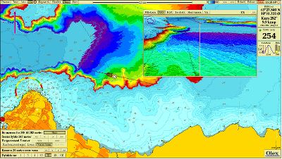
Calculating the shape of the seafloor
The system reads observations in four dimensions - time, depth, longitude and latitude - and upgrades a database where the sea floor is divided into squares of any resolution. The default resolution is 5X5 meter, an adjustment of today's inexpensive GPS equipment, but the user can easlily create new sea floor databases in any resolution down to a few cm. The squares may be considered as a grid covering the surface of the hole earth. They contain a depth value which are either measured, calculated or unknown.
OX2DD_Broschyr.pdf (2.3 MB)
OX2DD_Hårdvara M2 dator.pdf (711.8 KB)
OX2DD_Hårdvara M3.pdf (105.4 KB)
Print PDF
